Above: Pulama Pali lava breakout and sky taken late last night with a 15mm fisheye lens (click on it for large size)
I hiked to Royal Gardens subdivision, or the tattered remains of it, and talked with Jack Thompson. Above is his beautiful hand-built home, taken from the same spot as the view looking down his road remnant that leads to the active lava flow 350-feet away, and an ever present tour helicopter over the fuming lava.
And here, below, is what we can see of Jack's house from the other side of the hot lava flow at sunset last night. The lava is inside tubes and heading down to the sea. Jack's home is hard to see, but it is in the distance nearly hidden in the trees on the left, and is the same location I filmed that flow at its peak (that blog post here)
This December lava flow has just slowed down after covering miles of the coastal plains and pouring into the ocean, but late last night I witnessed an new large breakout of a`a lava on the top section of Royal Gardens about 2000 feet above Jack's house. Below is a photo of the Pulama Pali I took today with my notes indicating significant places and dates: Click on any image to open them all in larger viewer window.
~~~~~~~~~~~~~~~~~~~~~~~~~~~~~~~~~~~~~~~~~~~~~~~~~~~~~~~~~~~~
LAVA YEAR IN REVIEW, 2011:
January: Some of JANUARY 2011 highlights You can scroll down them all at once, but not all of January will show. We also lost a home to lava on the 18th.(house frame in upper left and circled in notes on aerial below:
February 2011provided some wonderful photo opportunities to me with some active surface flows: FEBRUARY postings
MARCH 2011 : On March 5th That day was the last coastal plains lava flow until the recent December Royal Gardens flow currently happening. That same day we had a major floor collapse within the Pu`u O`o Crater. Lack of acceable lava caused my blog postings to become very slim in the months following, but there were some reports:
April 2011
In June the action was inside the Pu`u O`o Crater as it also was in July & August. On August 4th, the crater floor collapsed again, spilling out volumes of molten lava fissures from its flanks.
This continued slowly expanding through SEPTEMBER, OCTOBER, NOVEMBER
And leading, finally, to the spectacular arrival of molten lava rivers down the Pulama Pali December 4th. spilling across the coastal flats at a rapid speed, and pouring into the ocean. All recorded on my five DECEMBER posts HERE
Thanks for dropping by my blog, it has been fun to share this ongoing Kilauea Volcano eruption with you,
All the best in 2012,
Aloha,
Leigh
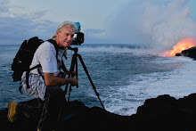
-Oh, and this is my self portrait taken today, December 31st, 2011-- The Earth according to Leigh ;)
Saturday, December 31, 2011
Sunday, December 18, 2011
Lava continues dropping off cliffs into the sea in Hawaii Volcanoes National Park
Dawn at the ocean entry December 17, 2011
The volume of surface lava being sent from fissures at Pu`u O`o Crater through insulating tube systems seven miles south to the ocean changes daily. Yesterday I went by boat to witness this. Another long time lava enthusiast, Shane Turpin took me out on his infamous Lavakai charter boat (his link below) in the predawn light. On this page I will share a few of the images I took as well as a short 1-minute 45-second video of the scene.
VIDEO: shooting movies from a boat without any stabilization can tend to roll around a bit … so I kept it short so you won't get seasick :)
For more information about Captain Shane Turpin and his Big Island boat charter options, unique history and photos, check out his online site See Lava
Here are some more of the photos I took: [Click on any photo to open them all as a set of larger images]
You can see more images taken on this day, and last week, as a slideshow, or any other viewing option you desire, here on my new: Royal Gardens flow flow 2011-2012 online gallery.
My last two posts will show where this lava was last week: Coastal plains lava And the massive lava rivers running through Royal Gardens on the hillsides of the Pulama Pali.
Sunday, December 11, 2011
Royal Gardens lava flow reaches the ocean 2-miles south
Image- Royal Gardens lava fires in the distance as molten lava reaches the shoreline.
At 6:15 in the afternoon of December 9th, lava from Pu`u O`o craters ongoing eruption began flowing into the ocean about two miles south of the old Royal Gardens subdivision. This is our first ocean entry since last February (2011), and also this time it is within the Hawaii Volcanoes National Park - although very inaccessible to the public.
I spent an afternoon out there and snapped these pictures (above and more further down) and also took some video of the pahoehoe doing all it's neat surface flow tricks. Here is a 2 1/2 minute collection of those clips:VIDEO
I was tempted to stay and watch it pour into the sea, but chose to leave and hike back with the last daylight. Two other photographers, Philip and Michael, stayed behind and got some great photos & vids too. It was Phil that later notified me of the official ocean entry time. You can view his great video of when the lava first dripped off the cliffs into the sea (we had been trying to guess) - Here is Philip Ong's video
He also had sneakily snapped a shot of me all splayed out on the lava taking videos, as seen below: Yeah-- I dress pretty covered up for getting close to a volcano goddess at work…
But I also snuck a shot of Philip guessing how long the lava would take to reach the sea...
I love all the endlessly crazy shapes this stuff can create! - Pele's handiwork as they say around here.>
In the days ahead we will find out if this flow will establish itself thru insulating tube systems, or be severed of lava by a plumbing system collapse, or possibly stop flowing due to a large, or sustained drop in magma pressures beneath Kilauea Volcano and the Pu`u O`o crater a little over seven miles uphill to the north. (You can always follow their daily updates here)
A few hardy souls made it to the leading edge of the lava streams. (CLICK ON ANY IMAGE HERE TO OPEN THEM ALL LARGE)
Below: Royal Gardens as seen from the coastal flats -- Jack Thompson's house, the reddish square near the middle of the forest and left of the dense smoke, has survived this flow so far-- as it should be! This is also the exact location of where I filmed those wild lava rivers!
**** So this will be my last report on the new flow for awhile. I do not plan to make regular trips across many miles of old, raw & wild lava fields just to check on this newly established ocean entry. But I will report any substantial changes to it.
>>> I am also working an a serious feature lava flow movie -- The story is nearly formed-- tons of hynotizing molten lava footage, edited and ready to go! -- Hey, if any of you know of a movie producer, or someone willing to finance this movie, please email me. I am also hoping to get certain well known composer (already picked) to lay the soundtrack -- but need help to do that too. Thanks for any suggestions! ****
~~~~~~~~~~~~~~~~~~~~~~~~~~~~~~~~~~~~~~~~~~~
Public lava viewing options:
The Kalapana Gardens Civil Defense Lava Viewing Area is still operating daily from 2PM to about 9PM at the very end of Highway 130. As of this writing: by day the distant Royal Gardens lava fumes and smoke from burning brush and trees can still be seen, and by night some red-orange lava glow is visible there too. But unless there are new breakouts on that pali, this view of the active eruption may fade from sight in the days ahead. Even the ocean entry steam plume will be too far away to be seen on most days, assuming it continues being feed by lava there.
There may also be views of the lava on the coastal plains from the lower section of the Chain of Craters Road, in the national park, some 4 1/2 miles away from the active lava.
Also, I believe there are one or two die-hard lava tour outfits still offering to take fit individuals the nearly seven-mile roundtrip lavascape hike the new ocean entry. Ask around in Kalapana
Wednesday, December 7, 2011
Video footage of Royal Gardens lava flow
This video below is a compressed look at what I witnessed at the forest remnants of Royal Gardens subdivision, filmed over a 16-hour period there, December 4th overnight to the morning of the 5th. The helicopter you see rising out of the burning forest is carrying Jack Thompson from his isolated home at 5:30 PM Sunday.
The vid:
All of these images come alive in the video ~~
A new thrust of A`a
Click on
any image to see them all larger.
Fields of pahoehoe
A massive set of A`a lava rivers pouring down the pali, dwarfing the forest beyond
pahoehoe on the right side and A`a on the left
EDIT December 9th: I am adding these excellent USGS/HVO aerial images to give a broader persecutive to where I recorded the video and photos: Where the lava is coming from: The Pu`u O`o Crater - These first two photos were taken the day after I filmed the event, Dec. 6th, 2011:
The image below shows exactly the area where I recorded the lava flow: specifically the entire top third of this terrain:Eruptive lava has radically changed the landscape in just 24-hours.
And here is another USGS image of the area taken on Dec. 2nd as lava as just beginning to enter the forests. The dotted lines were added by HVO to indicate where the molten lava was at that point in time:
If you would like to read my account of filming this event, I have a brief story here on my Flickr site.
~~ See my previous post for some other images and info ;)
Monday, December 5, 2011
East side Royal Gardens leveled by rivers of lava – Jack Thompson airlifted out
As I arrived yesterday afternoon to this last large remnant of the once expansive Royal Gardens subdivision, rivers of lava had already severed access to the kipuka itself, and to Jack Thompson’s home.
I was mostly shooting video, but below is the only still shot I grabbed of the chopper coming into to take Jack off his property and out of the lava zone at 5:30 PM yesterday - in the sky, upper left. (lava rivers are partially obscured from this angle). His house is beyond view, back in beyond the smoky forest. (According to helicopter pilots this afternoon, Jack’s home was still intact; and from my vantage point on the ground the lava was still roughly just a couple of hundreds yards east of his place.)
[Click on any image for a larger view size of all these photos]. The lava in this photo had already come through hours before my arrival, but as the images show, that was just the first wave – Once the molten lava found the very steep pali just to the left, more rivers of pahoehoe and large A`a mounds advanced aggressively into the night and today.
Large advancing mounds and thrust-fronts of moving A`a take all in its path:
At dusk last night the scene along the forest was one of fast lava rivers and devastation to the forest, lava rivers and the burning forest raged throughout the night:
This shows just how steep the pali’s (cliffs) are where all this lava was pouring off of - both the slower A`a (foreground) and super-fast pahoehoe - these rivers are much larger than appear here.:
Below: With open ocean in the distance, we look down on massive fields of A`a continuing to grow onto the coastal flats far below, as seen from the top of the pali. There are actually some people in the photo's mid-upper left side for perspective.Well it took nine months to the day for Pele to deliver surface lava back to the coastal plains, but she did so in her fiery style!!
See my previous post for more background information as to location.
I am now working on movie footage and will post a few clips on here in the next day or two.
Saturday, December 3, 2011
Lava enters Royal Gardens area
It has taken many weeks to reach the Pulama Pali region, but it has. Small sections of kipuka forest are slowly burning as molten surface lava enters these remnant portions of the old Royal Gardens subdivision and has proceeded within it, as shown in the USGS/HVO photo above. (click for larger size)
I have not made the hike to it yet – it’s a bit more of a trek than the event warrants-- but soon. There remains one occupied home in the mostly lava covered subdivision, that of Jack Thompson, who has miraculously escaped numerous lava flows on all sides of his beautiful home, long ago severing any road access. This flow will be his next major test. He has a couple of things on his side: history sparing it and this present flow has some old lava mounds above and adjacent to his property that may fend off the lava as it flows down hill near him. You can see Thompson’s home in the upper-center of the pear-shaped forest patch in the photo above (redish). Also in the photo, the approaching active surface lava is outlined, by the USGS, with white dots. (Read their full caption information here
The USGS/HVO has also posted updated flow maps of the eruptive zone, reposted below and with more information on their link above. USGS/HVO Maps and caption: Pu‘u ‘Ō‘ō and Episode 61 flow field: December 2, 2011
The pulsing type rhythm of the magma pressure below Kilauea has continued as demonstrated in the two graphs below: from November 22nd to today. Deflation/Inflation Tilt Graph
Saturday, November 26, 2011
Short video of Halema`uma`u crater fumes and glow
Taken at the same time I shot the still photos for my last post yesterday ~~
Oh, and very near the end, when I am zoomed in on the crater vent after dark, you will see a Hawaiian owl, called an pueo here, soaring across the top portion of the scene :)
All my lava related videos are on my YouTube channel here KumukahiHawk
My other random videos are on my Vimeo site here
Oh, and very near the end, when I am zoomed in on the crater vent after dark, you will see a Hawaiian owl, called an pueo here, soaring across the top portion of the scene :)
All my lava related videos are on my YouTube channel here KumukahiHawk
My other random videos are on my Vimeo site here
Friday, November 25, 2011
Thanksgiving at Halema’uma’u
One out of five people apparently enjoy the daytime view of the fuming crater :)
After sharing a Thanksgiving dinner with friends at Kipuka Puaulu (Bird Park) just down the road from Halema’uma’u, I drove to the Jaggar Museum where the best view of the crater is and took these photos to share with you.(Click on any photo for a larger view)
Dusk allows for the first look at lava glow reflected up into the toxic fumes for this tour group sitting along the upper drop-offs near Jaggar.
I love the leaning weathered ohia lehua trees that sparsely dot the massive crater.
March 19th, 2008 is when this active vent blasted its way through the main crater floor leaving a hole about 165 feet across. At that time molten lava was a long way down from the edge at around 650 feet below of the new vents rim. These days the broiling lake of lava inside there is holding at around the 250-foot mark but has been as high as within 135 feet of the vents rim, and the width of the nearly vertical walled vent is now 500-feet across! Infation/deflation magma pressures deep within Kilauea volcano fluctuate often, pushing up or draining down the lava lake inside.
After dark, back at the Jaggar balcony overlook. (Hawaii Volcanoes ational Park is open 24 hours a day, but the Kīlauea Visitor Center hours are 7:45 a.m. to 5:00 p.m. daily. and the Jaggar Museum 8:30 a.m. to 6:00 p.m. daily. ph#(808) 985-6051.
A zoomed in look at the entire vent and reflective lava glowing off surrounding rock walls
Subscribe to:
Posts (Atom)