Tuesday, August 31, 2010

~ Pele’s Heartbeat? ~

Pele's monitor at 11:00 AM this morning.
The USGS/HVO deformation - Deflation/Inflation: electronic tilt monitors are recording a pulse-like graph this week, similar to a heart monitor — Makes me wonder if Pele is in a stable and restful mode right now; taking a break from further expansion after an intense couple of months.

Ocean entry at 6:00 AM yesterday

This stable action continues manifesting on the coastal flats in the form of no surface breakouts and a steady flow of lava out off the edges of the deltas created between July 25th and today.

There are a few smaller ocean entry dribbles west of the main entry point about 1200-feet away, but most of the lava on the new benches flows into the sea across one central section directly south-southeast of the tube system providing it, which is this fuming area below:

Eastern edge of the main ocean entry early yesterday morning

~~~~~~~~~~~~~~~~~~~~~~~~~~~~~~~~~~~~~~~~~~~~~~~~~~~~~~~~~~~~~~~~~~~~~
Coastal lava viewing
Yes there will be lava sights to be seen from the viewing road even though the eruption intensity has diminished down in that area: fuming/degassing lines down the mountainside, the slim possibility of vegetation fires or lava breakouts near or far, vast areas of shiny new lava fields with fumes wafting from them, and steam rising into the air where lava continues entering the ocean a mile away and will glow red-orange after dark.
The county viewing area is located at the terminus of Highway 130 near Kalapana. For direct information on what is being seen from the viewing area each day you can phone the JanGuard security staff, stationed right on site, between 2:00 PM and 10:00 PM daily at (808) 430-1966 or the Lava Viewing Hotline: 961-8093

Halema’uma’u Crater
The Halema’uma’u crater has been degassing sulfur dioxide fumes by day and glowing strongly at times after dark from lava deep within the craters pit vent. The broiling molten lava moves up and down inside this massive eruptive vent at times, in kind of a pistoning action. Great views of this impressive crater are from the Jaggar Museum balcony within the Hawaii Volcanoes National Park, depending on the weather; and the park is open to the public 24 hours a day with a nominal entrance fee by day.

Sunday, August 29, 2010

~ Little change to lava flow in the past week ~

Lava continues running down the eruption zone, starting high on the mountain near Pu`u O`o crater and traveling underground via self-created lava tubes and re-surfacing as it pours directly into the sea eight miles distant.

USGS/HVO deformation - Deflation/Inflation monitors are showing magma/lava pressure changes that mimic at pattern we saw the week of August 12th to 18th, with fairly even swings for six days: Compared with the week of August 23rd to 29th

Coastal lava viewing
Yes there will be lava sights to be seen from the viewing road even though the eruption intensity has diminished down in that area: fuming/degassing lines down the mountainside, the slim possibility of vegetation fires or lava breakouts near or far, vast areas of shiny new lava fields with fumes wafting from them, and steam rising into the air where lava continues entering the ocean a mile away and will glow red-orange after dark.
The county viewing area is located at the terminus of Highway 130 near Kalapana. For direct information on what is being seen from the viewing area each day you can phone the JanGuard security staff, stationed right on site, between 2:00 PM and 10:00 PM daily at (808) 430-1966 or the Lava Viewing Hotline: 961-8093

Halema’uma’u Crater
The Halema’uma’u crater has been degassing sulfur dioxide fumes by day and glowing strongly at times after dark from lava deep within the craters pit vent. The broiling molten lava moves up and down inside this massive eruptive vent at times, in kind of a pistoning action. Great views of this impressive crater are from the Jaggar Museum balcony within the Hawaii Volcanoes National Park, depending on the weather; and the park is open to the public 24 hours a day with a nominal entrance fee by day.

Friday, August 27, 2010

~ Lava continues pouring strongly into the sea ~


Ocean entry at 5:30 AM with some tephra explosions on the upper right.

This ongoing eruption of lava from the Thanksgiving Eve Breakout (TEB), (named such because it began November 21, 2007, but has generated five separate lava flows, including this current July-August event), has established some fairly solid underground tubing systems all the way down the mountain, across the coastal flats and onto new delta/benches which deliver the molten rock directly into the ocean; a distance of eight miles or over thirteen kilometers including all the tubes twists & turns.

The tubing system is so entrenched that few surface breakouts have lasted more than a couple days, and none were visible last night from the lava viewing access road.

Public viewing options for witnessing the two accessible active lava zones are listed near the bottom of this this August 25th, post

Rainbow along the Hawaii County lava viewing access road yesterday afternoon

Wednesday, August 25, 2010

~ No surface lava visible from viewing area but ocean entry is strong ~

The ocean entry steam plume is still fuming strongly during the day and glowing orange and red at night and at times appears as two or three plumes. Two cruise ships went by the coast there last night and one of them actually stopped to let their passengers see the lava pouring into the sea. In the photo above I caught them just pulling away and back out to sea.

Recent surface lava outbreaks that we have been seeing south and west from the Hawaii County lava viewing area were not visible last night--- changing daily it seems.

Coastal lava viewing
Yes there will be lava sights to be seen from the viewing road even though the eruption intensity has diminished down in that area in the past couple of weeks: fuming/degassing lines down the mountainside, the possibility of vegetation fires or lava breakouts near or far, vast areas of shiny new lava fields with fumes wafting from them, and steam rising into the air where lava continues entering the ocean a mile away and will glow red-orange after dark.

The county viewing area is located at the terminus of Highway 130 near Kalapana. For direct information on what is being seen from the viewing area each day you can phone the JanGuard security staff, stationed right on site, between 2:00 PM and 9:00 PM daily at (808) 430-1966 or the Lava Viewing Hotline: 961-8093

Halema’uma’u Crater
The Halema’uma’u crater has been degassing sulfur dioxide fumes by day and glowing strongly at times after dark from lava deep within the craters pit vent. The broiling molten lava moves up and down inside this massive eruptive vent at times, in kind of a pistoning action. Great views of this impressive crater are from the Jaggar Museum balcony within the Hawaii Volcanoes National Park, depending on the weather; and the park is open to the public 24 hours a day with a nominal entrance fee by dayPhoto taken from the Jaggar Museum balcony.

Tuesday, August 24, 2010

~ No significant changes: lava flowing into the ocean – small surface breakouts ~

Above: ocean entry at 5:20 AM
Coastal flats breakout below:

I have added some new images to my Kalapana Lava Flow of 2010 online gallery here

I may not post updates as often until, or unless, significant changes to the lava flow take place.

USGS/HVO lava flow maps page shows the hot zones as of July 17th, 2010. Click on the map images to open their larger sizes.I saw a USGS guy out mapping the surface flow breakouts two days ago so we may be seeing a new flow map update soon.

USGS/HVO deformation - Deflation/Inflation monitors are showing magma/lava pressure changes that so far probably have little affect on the coastal lava flow:

Sunday, August 22, 2010

~ Lava still flowing strong into ocean ~ New coastal flats breakouts ~

Lava river flowing into the ocean this morning.

Lava down on the coastal flats and into the sea has re-energized producing numerous breakouts in both locations as the photos above and below show.This pahoehoe is flowing into the kipuka forest and across the flats in a broad and extending zigzag arrangement and will be easily seen today and tonight from the Hawaii County viewing access road, which is only about 1200-to-1800-feet away.
This breakout lava is located next to the last fragment of Highway 137 near the old parking area we had until it was covered by lava May 5th and again a few times in July. One of the garbage cans that was at that parking & viewing area was still waiting to be used-- Pulama Pali is fuming in the distance. The more silvery lava in both the photos above are hot and breaking out in places.

... And those two big old mangos that gave us shade and lots of fruit are now smoldering hunks leveled by Pele.

Inflation of lava into the eruptive tube system is what brought all of this back into action:

Friday, August 20, 2010

~ Further reduction in lava activity within the eruption zones ~

After such a powerful month or more of volcanic action from mountain to sea, things are really settling down right now. Click on the highlighted words here to see my post A month in pictures of a lava flow to see some of these highlights.

I am very curious as to what this volcano will do next when inflation returns: will it simply reenergize? - Breakout in new places on the mountain or coastal flats? - Re-inflate near Kalapana Gardens homes? – Or surprise us with a new twist as is often the way of a Volcano Goddess like Pele (pro. Pay-lay) … like starting an entire new eruption flow…

Presently a serious drop in magma and lava pressures is taking place and being recorded on the US Geological Survey/Hawaiian Volcano Observatory (USGS/HVO) tiltmeter graphs; especially at the Pu`u O`o crater, which is where the coastal lava flow originates from: erupting from nearby and running through tubes all the way to the sea miles below.

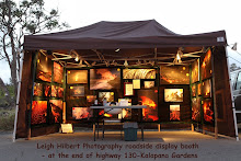
For me personally, I am taking advantage of Pele’s pause and focusing on my new movie, which will take weeks of concentrated effort. I will also be continuing to set up my lava photo display booth at the county viewing area a few days a week.

Coastal lava viewing
Yes there will be lava sights to be seen from the viewing road even though the eruption intensity has diminished in the coastal flats area: fuming/degassing lines down the mountainside, possible vegetation fires or lava breakouts near or far, vast areas of shiny new lava fields with fumes wafting from them, and steam rising into the air where lava continues entering the ocean a mile away and will glow red-orange after dark.

Halema’uma’u Crater
The Halema’uma’u crater has been degassing sulfur dioxide fumes by day and glowing strongly at times after dark from lava deep within the craters pit vent. The broiling molten lava moves up and down inside this massive eruptive vent at times, in kind of a pistoning action. Great views of this impressive crater are from the Jaggar Museum balcony within the Hawaii Volcanoes National Park, depending on the weather; and the park is open to the public 24 hours a day with a nominal entrance fee by day.

For direct information on what is being seen from the viewing area each day you can phone the JanGuard security staff, stationed right on site, between 2:00 PM and 9:00 PM daily at (808) 430-1966 or the Lava Viewing Hotline: 961-8093

I may not post my lava reports as often until some new changes to the eruption activity begin…. You can always go back through my blog and read-up on all the days you missed :)

… There is some nice south surfing swells coming into the shores now… see you down there…

Thursday, August 19, 2010

~ Entire eruptive system cooling down ~

Cooling may not be the right descriptive being that 2000-degree lava continues cursing through miles of underground tubes and pouring into the sea, but the pressures driving the lava have been slowing declining for the past week. A further plunge in magma pressures beneath Kilauea Volcano right now has added to the decline, as the USGS/HVO electronic tiltmeter deformation monitors are revealing:

At 10:00 PM last night I stood on the Kalapana Gardens access road near the county viewing area and scanned the Pulama Pali, coastal flats and ocean entry for signs of surface lava activity. I saw no pronounced lava on the pali but there were a few small blobs of red here and there across the coastal flats, including a bit of a breakout off the end of the viewing area access road; the breakouts reported there the past few days have stagnated. The ocean entry had changed significantly from the nights before: there are now two main entry glows – a brighter one where it has been strongest this past week and a second glow far west of there, which would be at the end of the new lava that had advanced into that section of coastline a couple of weeks ago, but then had stopped. It may be on the move again. That said, both these ocean entry plume glows were very subdued compared with any previous night since the lava first found the ocean on July 25th. I took no photos of this.

Yesterday a number of people on the Puna side of the Big Island felt the small 3.8 earthquake located five miles west of Kalapana at a depth of six-miles.

Our Volcano Goddess Pele left a nice heartprint out on the coastal flats that I share with you here:

Wednesday, August 18, 2010

~ Surface flows in Kalapana small and slow ~

Field lava researcher and friend Ron Boyle snapped a few photos yesterday of the new molten lava breakouts that are on the end of old Highway 130, or the Kalapana access road viewing area.

A couple of days ago these breakouts started out fairly strong and fast moving but have since slowed way down and causing little threat to homes in the area at this time.The breakouts and burning vegetation are making for some good photo opportunities for those visiting the lava flow.

USGS/HVO D/I monitors have been registering some wild pulse-like swings this week as shown in the recent graph below. Makes me wonder what Pele is up to when this happens: is she about to ramp up or ramp down this July-August thrust of molten rock?

Lava continues pouring into the ocean in one main area that lies about ½ to ¾ of a mile south of Kalapana Gardens at the closest point and easily seen day and night from the Hawaii County viewing area. After dark the plume of steam glows red and orange by the reflective lava below it.

Tuesday, August 17, 2010

~ New lava breakout erupts near Kalapana access road and moving east ~

So what could these people perched at the Hawaii County lava viewing area be looking so intently at if the ocean entry plume is to their left?

A large and rapidly spreading breakout of pahoehoe has erupted from the lava tube system on the coastal flats in the past 48-hours. This was happening only a few hundred yards west the viewing area access road last night. Just after dark this breakout the visitors were fixated on looked like this at 7:15 PM:


As darkness set in the lava viewers had two exciting scenes to look at; the surface flow breakouts and burning forest to the west and an ocean entry to the south


I did not make it back down there this morning to document the overnight progress of this new surface flow but I will get some updates later today and add them to this posting, or have them on here tomorrow.

This new breakout is advancing easterly and poses a threat to the nearby Kalapana Gardens homes should it continue on its present course.

Monday, August 16, 2010

~ A month in pictures of a lava flow ~

A lot lava has happened in the past four or five weeks on the south side of the island of Hawaii; our local Volcano Goddess has changed things up a bit. Below is a condensed recap of some of these events in pictures and captions: Above: Pulama Pali July 9th, 2010 - looking southeast -Kalapana Gardens upper left. Flow front at 400-foot elevation


Leading edge of lava flow after sunset July 9th, 2010


Coastal flat lava flow July 16th, 2010


Coastal flat lava flow July 16th, 2010


Lava covers another portion of Highway 130 (Kalapana access road) July 17th, 2010

Thousands gather to witness lava crossing more highway and burning through swaths of forest: July 18th, 2010


Homes in Kalapana Gardens threatened by lava July 22nd to 24th, 2010

Under a full moon, lava advances to Gary Sleik's home: 2:45 AM, July 25th, 2010


Can you imagine looking out the window of your home and seeing lava in your yard and your gardens going up in flames? Gary Sleik's home, 11:00 PM July 24th, 2010


Gary Sleik's home ignited by lava at the base of the front stairs at 3:15 AM, July 25th, 2010


Darlene and Gary watch the home they built together five years ago, and in which Gary lived alone in the following years, burst into flames after being overtaken by the lava flow- 4:00 AM, July 25th, 2010


Lava reaches the ocean at 2:00 PM July 25th, 2010 and begins spreading up & down the coast


Coastal lava flow July 29th, 2010


She came to camp at Fox's Landing but found lava pouring off the cliffs and down the pebble and black sand beach. July 29th, 4:00 PM


Fox's Landing July 29th


Fox's Landing July 29th


Fox's Landing July 29th


In the weeks following the lava drained into the ocean and lessoned the threat to other homes, but left a fuming wasteland in its wake.

Coastal ocean entry lava, August 6th, 2010


A 20-acre lava delta/bench formed within two weeks of the lava entering the sea, August 7th, 2010


Kalapana Gardens - August 13th, 2010

{I may be posting updates on the lava flow less often until new activity starts up-- I also need the time to work on a new lava flow movie documentary,
Aloha,
Leigh