 (Click the images for larger view sizes)
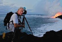
Two visitors to the island were with their guide, who is out of frame, are watching some small surface flows near the ocean as the sun rises. This was at the far western lobe ocean entry Sunday morning.
Just two days ago we were witnessing some very large surface flows of lava across the coastal plains west of Kalapana. By Sunday nearly all breakouts had crusted over.
Even the two ocean entries were very subdued. I did not hike out to the eastern entry but I could see a feeble steam way off in the distance.
There has been no pronounced magma chamber deflation to account for the sudden drop in coastal activity, but according to USGS lava updates, there have been heightened surface flows high above the Pulama Pali and inside the Pu`u O`o crater the past few days (The Pu`u O’o quieted for a day but was flowing with lava rivers again at 8:00 PM Sunday night). Maybe the lava tubes leading to the sea have been partially severed.


For the first time in a year or more I hiked inland and west from the coast for a few miles. I was surprised just how extensive the recent lava flows have become; miles of the coastal plains have molten lava laying a short ways below the crusted surface. I would love to see a new USGS thermal/aerial overlay of the entire coastal plains.
One surprise I spotted was what appeared to be degassing fumes far to the west of Kalapana Gardens – all the way into the Hawaii Volcanoes National Park. Though I was still quite a ways off, these fuming lines ran from near the western base of the Pulama Pali all the way southwest to what seemed to be a possible ocean entry plume…. I have heard of no other reports of any activity down that way, so maybe it was an early morning anomaly of fumes. Below is a rough composite of three shots showing the fumes in question in the distance. Click on the image if you want to see it larger.

USGS has posted some new flow-field maps. Below are the maps, click the link above for the captions on their site.


~~~~~~~~~~~~~~~~~~~~~
I will post my next update as soon as eruptive conditions on the coastal plain have changed, or if other significant volcano news takes place.
Onsite coastal lava flow information and viewing conditions can be found by phoning Janguard lava viewing security management who are stationed along the access road at the end of Highway 130 from 2:00 PM until 10:00 PM daily: 430-1966


No comments:
Post a Comment