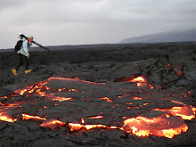
Taken at the same time I shot the still photos for my last post yesterday ~~
Oh, and very near the end, when I am zoomed in on the crater vent after dark, you will see a Hawaiian owl, called an pueo here, soaring across the top portion of the scene :)
All my lava related videos are on my YouTube channel here KumukahiHawk
My other random videos are on my Vimeo site here
Saturday, November 26, 2011
Friday, November 25, 2011
Thanksgiving at Halema’uma’u
 One out of five people apparently enjoy the daytime view of the fuming crater :)
After sharing a Thanksgiving dinner with friends at Kipuka Puaulu (Bird Park) just down the road from Halema’uma’u, I drove to the Jaggar Museum where the best view of the crater is and took these photos to share with you.(Click on any photo for a larger view)
 Dusk allows for the first look at lava glow reflected up into the toxic fumes for this tour group sitting along the upper drop-offs near Jaggar.
 I love the leaning weathered ohia lehua trees that sparsely dot the massive crater.
 March 19th, 2008 is when this active vent blasted its way through the main crater floor leaving a hole about 165 feet across. At that time molten lava was a long way down from the edge at around 650 feet below of the new vents rim. These days the broiling lake of lava inside there is holding at around the 250-foot mark but has been as high as within 135 feet of the vents rim, and the width of the nearly vertical walled vent is now 500-feet across! Infation/deflation magma pressures deep within Kilauea volcano fluctuate often, pushing up or draining down the lava lake inside.
 After dark, back at the Jaggar balcony overlook. (Hawaii Volcanoes ational Park is open 24 hours a day, but the Kīlauea Visitor Center hours are 7:45 a.m. to 5:00 p.m. daily. and the Jaggar Museum 8:30 a.m. to 6:00 p.m. daily. ph#(808) 985-6051.
 A zoomed in look at the entire vent and reflective lava glowing off surrounding rock walls
Monday, November 21, 2011
Molten lava again visible from Big Island coastal community
 USGS/HVO images page caption states, "This photograph, looking east, shows a large skylight on the lava tube that is supplying lava to surface flows north of Royal Gardens subdivision. The tube trace, which heads southeast, is marked by the line of fume sources in the upper right portion of the image. The surface flows, out of view in this image, were 1.1 km (0.7 miles) north of the uppermost street in Royal Gardens today." Closer look at that huge skylight:
  photos courtesy USGS. Click any images for a larger size in new window.
Residents of Kalapana Gardens community have been notifying me that in recent days they can see, after dark, surface lava just above the area that once was the Royal Gardens subdivision. (The subdivision has been repeatedly inundated with lava flows since the early & mid 1980’s; only one home, apparently still occupied, remains intact.) Coastal lava abruptly stopped flowing on March 5th this year when a violent fissure erupted southwest of Pu`u O`o crater, which also significantly collapsed inside. The crater rebuilt its floor, collapsed again with another fissure rupture in August, and rebult again, only this time the fissures have been draining more steadily from the most recent southeast crater flank.
Leading easterly from that fissure on the southeast flanks of the Pu`u O`o crater, active lava tubes have been formed, insulating and carrying the lava further towards the coast. As depicted in the tilt graphs below, an up tick of inflation/deflation magma pressure cycling has likely helped to create this situation. Below - Nov. 9th to the 16th:
 and today's graph: 14th to 21st -nearly consistant day and a half pulses for the past two weeks or so - more closely spaced than previous weeks/months, which were averaging around 2 to 3 days per D/I cycle.
Current USGS/HVO flow maps, below and last updated on November 21st, show in red the new advancement of the lava, which is reported to be pahoehoe on the leading edge. This leading front is now about 3 ½ miles, or 5 kilometers, from Pu`u O`o and about a half mile north by northwest of Royal Gardens, and also about a half mile east of the national park boundaries. This puts the distance to the nearest coastline at around 4 miles or 6 ½ kilometers.
 Click on images for large size
If this flow of lava continues on its present track it will soon begin reaching the steeper terrain of the Pulama Pali, which could escalate advancement if magma pressures within Kilauea remain in this more compact cyclic pattern, or simply has a prolonged-sustained rise; time will tell.
As always, you can keep informed on Kilauea’s volcanic activity by following the USGS Hawaiian Volcano Observatory updates and associated links.
Saturday, November 5, 2011
Wild weather week! My house gets pounded at night by lightning storm! (video)
 Starting with the above Jack-O-Lantern Halloween sunrise October 31st, and the spectacular sunset of the same day (at page bottom below), we experienced heavy rains on all the Hawaii islands the following four days, culminating in a spectacular thunderstorm the dark wee hours of Friday morning November 4th. (two Video choices below)
Friday’s radar image and advisories:
 This is hours BEFORE it got serious! The sidebar on the weather site had with it a long list of weather warnings.
Below is a video I just made of the lightning, winds and rains lashing my home. Underneath is my commentary to go with that
Turn your audio up and go for the storm ride!
A second version below is Fast and furious with some different footage! -
WHAM-BAM 90- seconds version of LIGHTNING STORM Hawaii from Leigh Hilbert on Vimeo.
At 4:00 AM Friday morning November 4th, 2011, as with many people on the east side of the Big Island, a sharp Ka-Boom of thunder and brilliant flashes of light abruptly woke me. I leapt out of bed and in the dark grabbed my camera and began filming the storm.
My home is three stories high with my bedroom -loft at the top above the ohia trees, from there I have a 360 degree view from ocean to mountain, with Cape Kumukahi and its lighthouse just to the northeast. (the lighthouse light & tower can be seen in lower left corner of the last flashes at the end of the video.
As I filmed off my decks on each floor, a serious set of thunder cells pilled one atop the other while the wind gusted up faster, the rains came harder (dumping six-inches here in ten hours!) and the sky lit with many-hued lightning flashes nearly continuously all to the sharp claps and heavy booms of rolling thunder.
This was not a short-lived event, lasting about three hours in all; though I think I slept through the early stages. The National Weather Service in Honolulu had the day before forecast for East Hawaii Island "A slight chance of thunder storms" ... I think the video footage tells the real story!
-------------------------------------------------------------------------------
Halloween:
 Sunset sky on Halloween this week. To go along with my sunrise shot at top of page, the sunset that same day wash pretty cool too: The above shot was taken with a fisheye lens about ten minutes before the one below-- cool lacy blueish clouds in the middle of the bottom shot. Both images were from my home. Click any mage for larger size in separate window.
Subscribe to:
Posts (Atom)


