 (Click on the photos for a little larger size)
------------------------------------------------------------------------------------
MAY 3rd EDIT and Overview aerial map:
The roads end viewing area might open later today.
Here is a recent USGS aerial photo that I added a map and some rough notes to:
 (click on it for a larger size)
------------------------------------------------------------------------------------
From yesterday: There seems to be some confusion as to why the two accessible lava-viewing sites on the coast are both closed to public access; as of 2:30 PM yesterday. Whutz up with that!
I have walked the trail out to the original Waikupanaha viewing site as recently as an hour ago (Along with a hundred others) and I could not find any zones that would endanger the public unless we had a steady change of wind direction, even then the occasional vegetation smoke is distant and sparse, and the toxic plume at the ocean entry is still small enough to walk away from should it blow back towards spectators. As most locals know, the safest time to view a molten lava ocean entry is in the early stages, as this one is; having only found the sea three days ago.

The view from the older view site is stunning and should be witnessed before it does get covered or ends.

I can understand the Hawaii County or State authorities wanting to stay on the safe side with a new lava flow but in my humble opinion they have gone too far over the safe side. For two years the public had to watch the lava going into the sea from ¾’s of a mile away and now we finally have a totally accessible, and spectacular, established and slow moving surface flow of lava and not only is the Waikupanaha viewing site remaining off limits, those in charge(?) have even closed off the end of the road viewing site!
As of this writing there is no threatening lava at the end of the road viewing area – just one small hot spot that has hardly progressed in two days. Down the trail towards the ocean site there are a few hot-spots of lava that lie within thirty feet of the trails end that, yes, could break out and ooze a few more feet. I see not urgent threat there either.
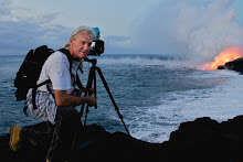
As a professional photographer, I have been hiking this lava flow for thirteen years and base my assessments on my experience. I am not alone in this opinion. In speaking with other highly molten lave experienced professionals, including a volcanologists who is of the same opinion.

The end of the highway-viewing site is now completely dismantled of barriers. The port-o-potties have been removed and relocated a mile east along the road… Not too handy for those that DID travel here to view the lava, only to end up at the end of highway 130 pavement looking at the distant pali fumes. Besides the 1300 mainland visitors, our neighbor island residents flown over to the Big Island just to watch the well advertised lava show, only to be turned around! Parking has been reduced to a small area forcing latecomers to park a mile or more east and walk all the way to the west end of 130, again, only to find out there is no lava viewing allowed.

Meanwhile, in this long-winded post, there is a new and very hot & large lava flow up high on the pali that could really do so creation & destruction Pele style if it comes down hill as strong as it appears to be.


No comments:
Post a Comment