Monday, April 29, 2013

Hawaiian molten lava continues from crater to sea


Above: In the pre-dawn magic time light, molten rock rivers bust out on a newly forming delta and over the edge into the ocean.Not much has changed along the ocean lava entry points in recent weeks; some new black sand beaches have come and gone and there is a slowly growing lava delta bench forming, as seen in the above image and the photo below:


 Other small changes have to do with the volume of molten lava being sent down from Pu`u O`o crater as magma pressures beneath Kilauea Volcano fluctuate fairly regularly.


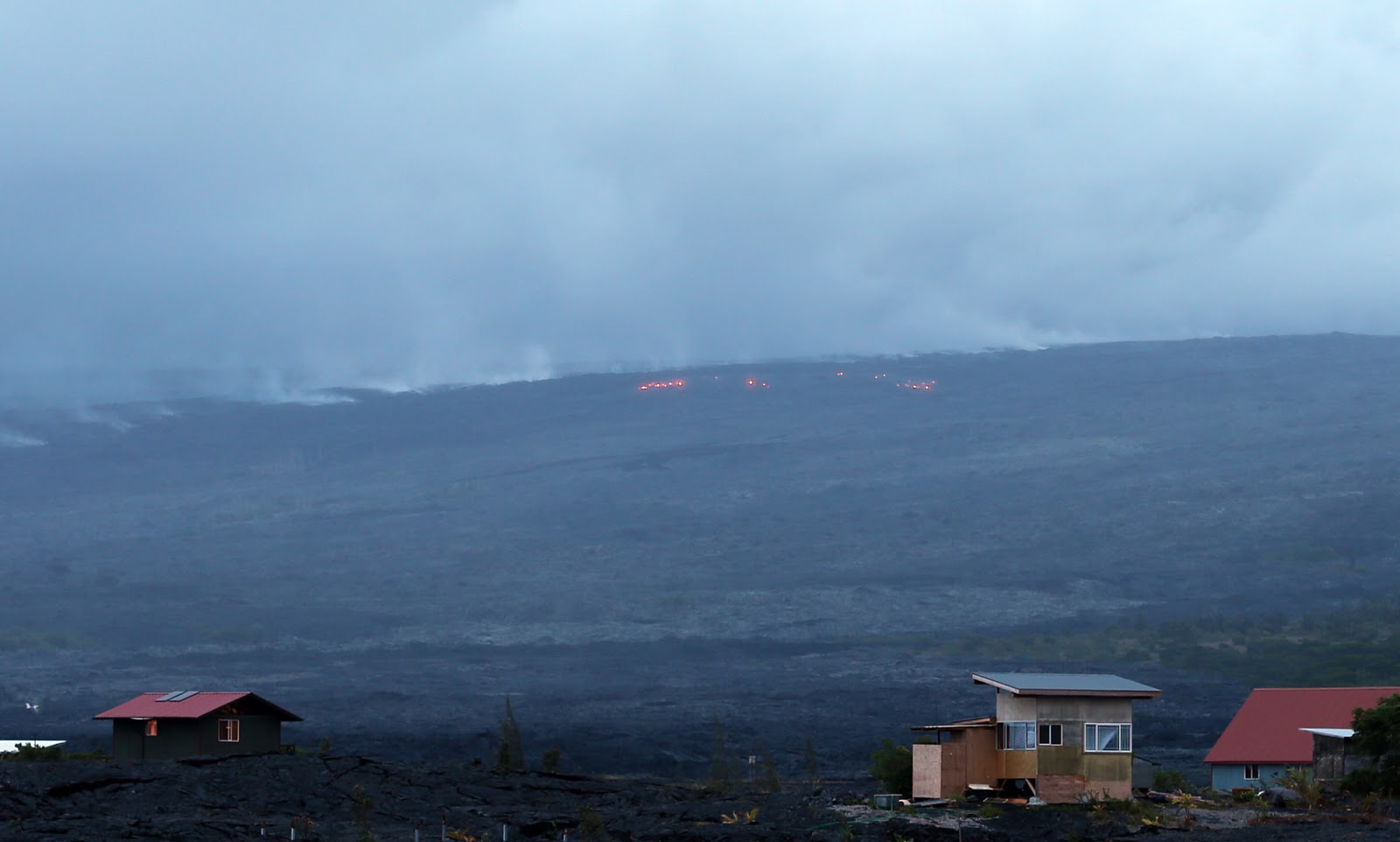
(Above: At dusk yesterday: Looking west from Kalapana Gardens: degassing lava tubes and some new surface breakouts east of the tubes)
(Above: My sometimes lava hiking buddy, photographer Ron Boyle sets up for a shot of a breakout under this weeks full moon)

During high-pressure cycles we will see new surface breakouts all the way along the lava tube plumbing system; from above the Pulama Pali all the way down it and across the two-miles of coastal plains to the ocean.
Also the lava flowing into the ocean surges during magma inflation periods.
 That magic pre-dawn light again. All lava photos were taken in the past three days.

Meanwhile;
The other Pu`u O`o lava that has been of concern, the Kahaualeʻa flow, has stagnated apparently, as stated by recent USGS Hawaiian Volcanoes Observatory (HVO)observations. They posted some infrared images on their photos and videos page

The Pu`u O`o Crater is very full of lava now as lava has been erupting out onto the crater’s floor quite often. At 1:00 AM on April 20th one such eruption was strong enough to reflect brightly onto the clouds as seen in this photo I took from Kalapana Gardens at 1:12 AM that night, seven miles distant.
 You can also see some breakouts of lava on the pali.
I wonder if we will see another large flank rupture soon, or maybe an increase in the lava flowing to the sea.

Halema`uma`u Crater continues broiling with molten lava within its rising and falling lava lake inside.

Below is a shot of Halema`uma`u Crater I snapped while in the Hawaii Volcanoes National Park a few days ago. I was surprised how wispy thin the outgassing plume was.


NOTE: Click on any of these images to open a new window with them all and larger view sizes (You can return here by clicking the little X in the upper right of that new window.)
 

I'll offer updates as conditions change~~ Aloha

Wednesday, April 17, 2013

Fairly consistent eruptions from Kilauea Volcano


Above: A crescent moon sets into the upper slopes of the Pulama Pali, with numerous lava breakouts next to it. 

Besides the huge molten lava lake within the Halema`uma`u crater floor vent that broils on, the Pu`u O`o crater continues feeding two lava flows: the Kahaualeʻa flow running through tubes, which now reaches about 5 km (3 mi) northeast from the crater USGS/HVO status page  , and the ocean entry lava 10 km (7 miles) south east of the crater.

Current Pu`u O`o lava flow map, courtesy USGS/HVO maps page Shows the active portions of both lava flows: red indicating active sections. (click on it for larger view size)


From all accounts, the Kahaualeʻa northeast flow front is approaching forests after sprawling across older (2007) flows but activity is progressing slowly, somewhat relieving our concerns of that lava heading downhill anytime soon. That flow still has the ability to turn downhill towards the southeast towards Kalapana as it skirts the 2007 flow.

Click on this image for a larger view size for reading my notes easier:


Meanwhile, here are some more images taken yesterday morning of the two ocean entry points along the southeast shores of the Big Island:
Above: Most easterly of the two ocean entries; April 16th at dawn.


 Above: 2nd ocean entry, about 1/3 mile west of the 1st. :building a small lava delta bench.

Click for larger size

Tuesday, March 26, 2013

Pu`u O`o crater sends lava two directions thru March


Lava continues entering the ocean seven miles downslope of Pu`u O`o crater on the south side of the Big Island. The daytime ocean entry steam plume and evening lava glow can be viewed from the Hawaiian County Lava Viewing Area located  off the very end of Highway 130 near Kalapana.

Here are a couple more early morning photos taken this week.


And this one with a lava spout at the ocean surface:
Click on any image for larger image sizes of all photos.

Meanwhile, up on the other side of Pu`u O`o lava continues slowly advancing northeastward. This could still become a potential new hazard either near Pahoa Town or Ainaloa subdivision... or it could possibly turn southerly and drop down towards Kalapana area... Or simple continue to sprawl across the flatter terrain it currently flows at... Or cease altogether--- It is worth keeping an eye on.


Wednesday, March 6, 2013

Video footage of ocean entry lava flow Hawaii


A long stretch of coastline now has lava finding the sea.

I put together some clips of the molten lava pouring into the ocean for a short video of the action out there, and also a few still images from this week.

Below are a few more from recent days:


~~

Click on any still image for larger view window of all of them.

Wednesday, February 27, 2013

Pu`u O`o continues sending lava to the coast, and elsewhere


Above: (Nearly) Full moon night rainbow taken last evening around 10:00 PM
We are looking west across Kalapana Gardens. The text on the photo describes more of the scene. You can click on it for a larger view window.

The surface lava tube breakout in the middle, just overtop the houses, was new to the overall scene we have usually had these past weeks. It was a bright and intense breakout and had ignited some forest sending balls of yellow flames into the air. This forest kipuka would be very near to where Jack Thompson's place was located until it was consumed by lava on March 2nd last year.

Meanwhile, up on the Pu`u O`o crater lava has been spewing out the northern flank for some weeks now--- Mostly flat terrain right there but if the lava surged heavy and prolonged in that area it could, in time, pose new threats to communities makai of that elevation.
The USGS/HVO have been documenting this event, and the Halema`uma`u Crater well and you can see photos and descriptions on their 'Photos & Videos' web page, which is where I grabbed this great overview image below of the ocean entry lava with the Pulama Pali on the right.

If you click for the larger size you can see, in the shadows on the bottom right, a helicopter and also white pillars that were once the foundation of a cabin until it was taken by lava about five years ago. Also, for those that remember the big Waikupanaha ocean entry we had from January 2008 until January 2011, it was located in the very bottom right corner of the photo.

Photos below: Waikupanaha lava viewing area July 2008 (click any photo for a lager size viewer of all images)                                


Monday, February 11, 2013

Kilauea lava from Pu`u o`o crater robustly (at times) pouring into the sea

Three miles southwest of Kalapana Gardens subdivision, and the terminus of highway 130, molten lava continues to find its way through lava tubes originating from Pu`u O`o crater seven miles upslope.
Many visitors with tour guides and locals make the hike out to this world wonder each day and night; taking about 45 minutes to an hour to walk across the uneven lavascape; depending on conditions.
The volume of lava entering the ocean pulsates over the hours as magma pressures fluctuate within Kilauea volcano's reservoirs. Delivery amounts to the sea also vary with how much lava Pu`u O`o spews within its crater or down the flanks; sending the remainder downslope to the ocean. On the day of these photos the volume of molten lava was low.
Click on any image to open a larger image size view window of all photos. I'll update as new changes occur ~~ Aloha, Leigh