Tuesday, December 28, 2010

~ Coastal plain lava continues filling and spreading ~

(Click image for a large size) At its closest point to a home and to the present barricades that mark the County Viewing Area, molten lava outbreaks are 1200-feet (366 meters) distant toward the west.

West-southwest of the above surface lava is an additional broad area of other surface flows. These flows have now proceeded southeast from the base of the Pulama Pali, east of the quarry, alongside & overtop of the July lava tubes and past the buried location of highway 130 (Old Kaimu-Chain of Craters Road). These two flows are the leading edges of the December Quarry flow. There are also numerous breakouts further up the pali.

My last field report recorded the lava flowing northwest of these locations and about 1400-feet, or 427-meters inland from the present flow front.

USGS/HVO have posted some updated flow field maps that I repost below. The brighter reds are the most recent surface flow locations as of December 22nd; the flow front has advanced further south and southeast since. You can view them on their site and read the full captions here.

Electonic Tiltmeters are showing a little bit of inflation pressures for the first time in weeks:

I am still on vacation but thought I would check out the lava situation on the coast. I’ll check in again in about a week.

Meanwhile, no parking on the hot lava!

Tuesday, December 21, 2010

~ Winter Solstice & total lunar eclipse on full moon ~ Blogger takes a break ~


A full lunar eclipse took place last night in many northern locations (Dec. 20th or 21st depending on time zones). It was too cloudy here (at least at my house) to watch it due to a large and persistent winter rain storm across all the islands. This was a special eclipse: first full one seen on Winter Solstice in the northern hemisphere in 372 years and the next one will be December 21st, 2485.

I am taking some time off from my usual passions of lava and blogging. I will check in from time to time in the next couple of weeks, but will likely not have many lava updates. So, besides the USGS/HVO’s daily eruptive reports, you can always talk directly with Janguard personnel who are managing the Hawaii County Lava Viewing site. Phone after 2:00 PM up until 9:30 PM seven days a week at 430-1966 or 217-2215. Tom or Steve will give you a pretty good update on the coastal lava flow situation.

What an active lava year it was!

I was going to put together a Year-In-Review for the lava flow but realized there were so many remarkable events it made that task become daunting… So… I will suggest that you take some time in the next few days to browse back through these blog posts: try peaking at December 2009 to see what was happing then, Maybe click on each month of 2010 in the Blog Archive found on the far right further down the page. By clicking on a month you can scroll down through some of that months activities, and also select show older posts to quickly scroll down and review an entire months posting at one time; the images themselves often tell the story ;)

Mauna Kea: We have been getting some new snowfalls up on the two monster volcanoes. Mauna Kea Weather Center has a nice selection of cams and they can be viewed in time-lapse day-into-night—Sometimes very cool to watch. I like the Gemini cam view/ here is a sample of one of the time-lapse clips of that cam from December 14th

~~~~ Aloha,
Leigh

~~~~~~~~~~~ The last total lunar eclipse I saw here was August 27th, 2007 at midnight: Here are the images I took of the event:Exact total eclipse and a few stars

CURRENT MOON

Saturday, December 18, 2010

~ From the lava flows perspective ~

In this photo, taken last night at dusk, we are looking towards the southeast from the leading easterly front of advancing surface lava. In the distance we can make out some of the homes in Kalapana Gardens and the Hakuma Horst.(click image for a little bit bigger size. Those more distant homes are just under one mile from the flow front, the closest being approximately 2800-feet away(Peggy's qunset home), and about 3000-feet to the barricades of the Hawaii County lava-viewing site at roads end. The molten lava in the foreground is back-filling a low point of land; flowing northwest.

And the image below shows the same view after dark an hour later. Notice how much higher the lava in the foreground is — that is what we refer to when we mention surface flow inflation (not the other magma chamber inflation); the molten lava beneath the quickly cooling crust thrusts lava higher off the ground in large pillowy shapes.


The flow front we see here is burning through one of the last sizable patches of forest before flooding out onto the flatter portions of the coastal plain, which it has now begun doing.

This lava is not flowing directly toward any of those houses or the end of the road; it is flowing in a filling-sprawling & inflating way- but as of last night, basically in a southerly direction with a southeast bent. Below is the photo I posted yesterday showing the perspective of this lava flow as seen from those homes:(Including the quonset-shaped home I mention above)

I surveyed the lay-of-the-land and tried to guess where this lava may travel to if it continues being feed and progresses – not an easy call this time. That said, I think there is about a 40% chance this flow will reach onto and beyond the end of the road (where barricades are now), threatening the nearest home (Quonset house shown in yesterdays post) within the next ten days, making that a 60% chance it will flow on by and potentially threaten homes on the further end of Kalapana Gardens, near the Hakuma Horst, before reaching the sea.

This surface flow will likely begin sprawling across the lower coastal flats, filling low areas, pooling and inflating higher as it goes. Last July 14th, when the flow front was at this distance from the sea, this same sort of lava action decimated a vast amount of forest and burned one home before reaching the ocean eleven days later. We may see a similar scenario with this December flow; but Pele makes all those decisions around here. This lava seen here in these photos is east of both the July and November flows and tubes and the quarry, but will soon be intersecting them.

One big regulator of these flows is the magma reservoir pressure beneath the Kilauea Volcano. A strong and sustained rise or fall of pressure, as recorded by deformation monitors can greatly affect flow rates: low pressure (deflation) may slow or stall all or portions of the flow front, a rise (inflation) may increase all that activity. Currently the magma pressures are deflating:

There is at least a mile of active surface lava behind this leading edge, running way up the Pulama Pali, with some branches running far east of the other recently flowing lava tubes.

Go with the flow

Friday, December 17, 2010

~ Moonlit molten lavascape dazzles spectators – worries nearby homeowners ~

The entire active lavascape from the top of the Pulama Pali to the county lava viewing barricades are seen in this moonlit scene.
Taken at 9:30 PM last night with an ever-growing moonlight, I slightly over exposed the image so that we could see both the landscape and lava & forest burning colors. (Similar result as achieved with my layered images earlier last week when there was no moon and that I repost for comparison below)

Click on the above image for a large size (Then click on the opened photo to zoom-in)and look for these following things:
On the far lower left you can see the Hawaii County lava viewing barricades and a little bit of the access road. (Just a short distance to our left in the photo is where Jean’s house stood before burned by lava Nov 27th) The illuminated Quonset-style building is Peggy’s home, situated desperately close to the advancing lava beyond.

The bright yellower flames are where the molten lava is encroaching & burning through patches of brush and forests left behind from previous flows like islands of green; locally known as kipuka (key-pooh-kah). And all the way the Pulama Pali we continued surface breakouts of mostly pahoehoe lava.

I find it is interesting that the upper breakouts have not crusted over as the leading edge of the flow front comes down the mountain; usually the moving lava quickly create an insulated layer as it proceeds, which can form over time into established lava tubes. But this flow seems to be doing that much slower than the April-May, or July through November flows.

Compare the opening image above of the lava flow as it looks today with the earlier images I took over the past eighteen days as the neww surface flow advanced shown here below:
Lava breaks out to the surface at around the 1100-foot elevation and begins down the Pulama Pali.
Lava advances at down the pali at rate of about 100-foot elevation drop per day.

~~~~~~~~~~~~~~~~~~~~~~~~
~~~~~~~~~~~~~~~~~~~~~~~~
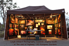
I randomly set up my lava photo display booth down at a little vendor’s area on the edge of the county viewing parking lot a couple of days/nights each week. And lately I have had the pleasure of meeting many of you who follow this blog. It has been really nice for me to get a chance to share our mutual fascination with this ongoing lava flow with so many of you.

I try to write an update each day but occasionally I am too busy to do that. I also will be taking a little Hawaii vacation soon—what to they call those now – ‘a stay-vacation’ or ‘staycation’ ;) I’ll be doing some camping with family and friends… I’ll let you know when I am leaving my blog post and for how long, but likely in the next week.

For onsite coastal lava updates and reports you can phone the security management down at the Hawaii County lava viewing site after 2:00 PM: 430-1966 or 217-2215

Thursday, December 16, 2010

~ Lava advancement may threaten homes again ~ Gary’s homestead re-revisited ~

The present flow front of lava that has been progressing down the Pulama Pali this past week has reached the edge of the coastal flats and burned through several remnant forest patches.

The big question now is how the lava will transit across the uneven ground below its current position. No one knows for sure. There are a few variables that can possibly affect the lava’s direction and speed of travel. The variables that come to mind are: 1) the overall inflationary pressures within the magma chambers beneath Kilauea Volcano, 2) the new rootless shield atop the pali that may have stored large amounts of lava in the past two weeks, which could rupture, and 3) breakouts further up the pali that may draw lava west of the July-November Quarry Flow tube system.
Current USGS deformation graphs are just beginning to record some inflation after a many days of little pressure change... I believe a large upward inflation period will really affect the eruptive activity down the pali system... But those affects remain to be seen...

Below is the most recent USGS flow field maps showing where the active lava was on November 26th, the day before it took out Jean’s house, and four days before lava stopped flowing onto the coastal flats and into the ocean. I have added a few rough notes showing the general location of the advancing lava as of today, as well as the location of the two homes lost to the July to November lava flow.Click on images for a larger size. And below is the broader flow field map:

Yesterday, Hawaii County Civil Defense alerted all property owners in and around the Kalapana Gardens subdivision area of the growing possibility of lava reaching the end of the access road within the next week. In that notice was an announcement that Civil Defense would close the lava viewing and attempt to secure the area … within an estimated 24 hours prior to lava reaching Kalapana Gardens. These notices were both mailed and hand delivered to residents.

~~~~~~~~~~~~~~~~~~~~~~~~~~~~~
~~~~~~~~~~~~~~~~~~~~~~~~~~~~~
Okay, as promised, here are photos I took in the rain of Gary Sleak’s. Two days ago I surveyed both Jean Olson’s recently burned out from lava house site and also Gary’s: The steam on the distant lava shows how hot the area still is as the rain come down.

For a good background report of Gary's site read my story with photos here> Gary's volcano viewing chairs Gary's gazebo roof survives its second encounter with flowing lava. The original gazebo was near his house until July 24th when lava burned it.

Wednesday, December 15, 2010

~ Pulama Pali alight with lava top-to-bottom – like a molten lava city at night ~

Moonlit pali at 9:00 PM last night reveals the large expanse of surface breakouts of lava running down the entire length of the Pulama Pali. (click on the image for a larger view size)

By today the leading fingers of this flow should be reaching the coastal flats; likely just west of Kalapana Gardens. We should have a more precise location by tonight.

Visitors to the Hawaii County lava viewing area were able to see this entire flow field and it may be even brighter and closer today and especially visible tonight. Should the lava continue at the present pace and direction, some of the more easterly leading edges of the advancing lava are showing potential to become a real threat to the subdivision homes in the days ahead.

(Yesterday I said I would post an update on the twice-burned out remnants of Gary Sleik’s homestead, I will now do that tomorrow)

For information about the on-site conditions at the county lava viewing area, phone after 2:00 PM and talk to personnel there: 430-1966 OR 217-2215

Tuesday, December 14, 2010

~ Remnants ~

I returned to the burned-out Kalapana Gardens home site of Jean Olson. Lava ignited Jean’s in the afternoon of November 27th then it filled in the area where the home and gardens were. You can revisit that story in photos and video here.

These photos document most of what remained: a variety of items were lifted up on top of the inflating lava, or left protruding from it. The lava in that area was still very hot to the touch and strong sulphur fumes wafted from fissures. Click any image for a larger view size.

Above: Embedded into the lava, lounging chairs (perhaps Jean's equivalent to Gary's lava viewing chairs) Just beyond the chairs is where the lava stopped advancing -(though the older lava looks similar in this photo) and spared a planted tree and what appears to be the property border corner pin-marking pole... And beyond that we can see the row of homes further east into Kalapana Gardens.

Below: The remains of the aluminum roof a partially stuck in cooled lava

Above: Clothespins cling to lines between lava-encased support posts.

~ Tomorrow I will revist, via photos, Gary Sleik's twice-burned out homestead.

Current lava conditions in the Kalapana area:

*Yesterday’s post has the latest info on the lava approaching Kalapana Gardens. Surface lava has now reached some kipuka forest and brush; sparking fires there.

These breakouts can be seen quit well now from the end of highway 130 and the extended single lane lava viewing access road.

Monday, December 13, 2010

~ Pali lava sprawling broadly – continuing down slope ~

Looking up the Pulama Pali at about the 500-foot elevation-- sprawling pahohehoe lava on all sides of the July quarry tubes.

Above: Lava Dave with two friends. In the background is Kalapana Gardens and we can see Dave's house in the middle distance.

Much of the lava breaking out was thin but a few places were making some nice roping and twisting.

Above: Here we can see just how close to this large old kipuka forest the flow is now passing.


While traversing the coastal plains I found some very hot areas, so hot they were glowing red between the cracks (The photo above was NOT taken on the coastal plain but up on the pali). Also, along the kipuka near the ocean, by the old Fisherman's Road, brush was burning... So there must still be some slow moving lava dribbling into the tube system in that coastal area. I visited both Jean's and Gary's house remains and will post photos of those two tomorrow.

Sunday, December 12, 2010

~ Storm watered dry side of island ~ Lava report unchanged ~

Our storm did place a blanket of snow over our two big volcanoes Mauna Loa & Kea. Above is Mauna Kea.
Photo courtesy of Big Island photographer Ethan Tweedie who specializes in majestic panoramic vista shots of the Big Island.

Just a quick post today -

The big blustery storm system did dump some heavy rain on all the Hawaii Islands, including areas that really have been struggling with serious drought for some time. Ironically, the normally 'wet-side' of the Island of Hawaii received the least amount of moisture from the storm, likely because the rain front approached from the west of the island thus creating a reverse affect of our usual east-north-east Trade Showers that leave the west side of the Big Isle dry.

I have not been out to check on the progress of the lava advancing down the Pulama Pali, but reports I have received from those that have are stating there has been little change since my last report here

USGS/HVO posted a couple new aerials of that surface flow on the pali that I have been taking pictures of looking up at from Kalapana Gardens this past week...

I will be checking it out further later tonight or tomorrow.

Friday, December 10, 2010

~ Winter storm sweeps Hawaiian Islands ~

Yesterday on the National Weather Service Forecast Office Honolulu I saw more warnings and watches posted of the Hawaiian Islands than I’ve ever seen at one time:

Severe Thunderstorm Warning

Flash Flood Warning

Special Marine Warning

Severe Thunderstorm Watch

Flash Flood Watch

Flood Advisory

High Surf Advisory

Small Craft Advisory

Wind Advisory

Winter Storm Watch

Marine Weather Statement

Short Term Forecast

Kauai was the first to feel the effects of an intense winter cold trough that is pushing down overtop the island chain. Warm southern air is being sucked up into the storm system and producing some serious wind, rain and thunderstorm conditions. Click this text for current > Hawaii Island radar rain loop

Kauai, Oahu, Molokai and Maui have all had a brush with the leading edge of the progressing storm, now it is the Big Island’s turn it seems: it is approaching our normally dry west side now and is expected to drench the island over the next 24-hours. See the various images and links for the latest. Click HERE to open the site with these interactive weather maps of Hawaii; like the one above.

Click on this highlighted link to open the Hawaii Islands water vapor loop (Right now it's looking pretty cool as the sheer-line of the storm is now slicing into the Big Isle:

I saved some of the more excited storm reports and then collected key lines or statements to share these snippets here with you: (This is an ongoing storm event so the list is incomplete)

BULLETIN - EAS ACTIVATION REQUESTED
SEVERE THUNDERSTORM WARNING
NATIONAL WEATHER SERVICE HONOLULU HI
1009 PM HST THU DEC 9 2010

* AT 1005 PM HST...RADAR INDICATED A LINE OF SEVERE STORMS FROM 8 MILES NORTHWEST OF TURTLE BAY TO 10 MILES SOUTHWEST OF KAENA POINT...MOVING TO THE EAST AT 25 MPH. WIND GUSTS UP TO 60 MPH THIS IS A DANGEROUS STORM.

THE NATIONAL WEATHER SERVICE IN HONOLULU HAS EXTENDED THE * FLOOD ADVISORY FOR THE ISLAND OF OAHU IN HONOLULU COUNTY...RADAR SHOWED MODERATE TO HEAVY RAIN PERSISTENTLY DEVELOPING OVER THE CENTRAL AND NORTHERN PORTIONS OF OAHU. THESE THUNDERSTORMS WILL PRODUCE STRONG WINDS 34 KNOTS OR GREATER...AND DANGEROUS CLOUD TO SURFACE LIGHTNING STRIKES.

IF YOU ARE IN ITS PATH...PREPARE IMMEDIATELY FOR DAMAGING WINDS...AND DEADLY CLOUD TO GROUND LIGHTNING. PEOPLE OUTSIDE SHOULD MOVE TO A SHELTER...PREFERABLY INSIDE A STRONG BUILDING BUT AWAY FROM WINDOWS.

NATIONAL WEATHER SERVICE HONOLULU HI...A FLASH FLOOD WARNING REMAINS IN EFFECT FOR THE ISLAND OF KAUAI ...THE ROAD TO HANALEI REMAINS CLOSED DUE TO WATER COVERING THE ROADWAY.

FLASH FLOODING IS IMMINENT OR OCCURRING IN STREAMS...ROADS AND LOW LYING AREAS. MOVE TO HIGHER GROUND NOW.

MARINE WEATHER STATEMENT:

HIGH SURF ADVISORY FOR NORTH AND EAST FACING SHORES OF NIIHAU KAUAI OAHU MOLOKAI MAUI AND THE BIG ISLAND...MARINERS CAN EXPECT GUSTY WINDS... LOCALLY HEAVY SEAS...DANGEROUS LIGHTNING AND REDUCED VISIBILITIES IN THE HEAVY SHOWERS AND THUNDERSTORMS. THUNDERSTORMS CAN ALSO PRODUCE WATERSPOUTS. SEEK SAFE HARBOR IMMEDIATELY...UNTIL THIS STORM PASSES.

FREQUENT LIGHTNING IS OCCURRING WITH THESE STORMS. IF CAUGHT ON THE OPEN WATER...STAY BELOW DECK. IF POSSIBLE...KEEP AWAY FROM UNGROUNDED METAL OBJECTS.

ALSO...A LARGE NORTH SWELL WILL CONTINUE TO POSE A THREAT OF MODERATE TO HEAVY SURGES IN KAHULUI AND HILO HARBORS TONIGHT. THE POTENTIAL FOR LARGE BREAKING WAVES NEAR THESE HARBOR ENTRANCES WILL ALSO PERSIST THROUGH TONIGHT. HEAVY SHOWERS AND THUNDERSTORMS WILL SPREAD FROM COASTAL WATERS * SURF...SURF ALONG NORTH FACING SHORES WILL BE 10 TO 15 FEET... AND SURF ALONG EAST FACING SHORES WILL BE 6 TO 10 FEET.

* IMPACTS...INEXPERIENCED SWIMMERS SHOULD AVOID ENTERING THE WATER ALONG NORTH AND EAST FACING SHORES WHERE DANGEROUS RIP CURRENTS CAN OVERPOWER EVEN THE STRONGEST SWIMMERS.

A WINTER STORM WATCH:
THE APPROACH OF AN UPPER LEVEL TROUGH FROM THE WEST WILL CAUSE SUMMIT TEMPERATURES TO DROP BELOW FREEZING FRIDAY NIGHT. ABUNDANT MOISTURE MOVING UP FROM THE SOUTH ALONG WITH THE COLD TEMPERATURES MEANS POSSIBLE HEAVY SNOW FRIDAY NIGHT … THERE IS A POTENTIAL FOR SIGNIFICANT SNOW...SLEET...OR ICE ACCUMULATIONS THAT MAY IMPACT TRAVEL...HEAVY SNOW POSSIBLE ON THE SUMMITS OF MAUNA LOA AND MAUNA KEA... SNOWFALL IN EXCESS OF 6 INCHES IS POSSIBLE ABOVE 12 THOUSAND FEET ...


Hawaii Island Mosaic radar image
~~~~~~~~~~~~~~~~~~~~~~~~~~~~~~~~~~~~~~~~~~~~~

Geminid meteor showers are showing soon: The peak will be on the night of December 13/14, 2010. I hope the clouds move off by then.

Lava report unchanged from yesterday.

Thursday, December 9, 2010

~ Lava breakouts continue slowly down pali ~ Flash flood watch posted ~

Just as I had done two days ago, I have layered day & night photos of the same section of the Pulama Pali surface flows so we can see where the molten lava is on the terrain. I would guesstimate the lower edge of this flow to be somewhere around the 600 or 700-foot elevation; or dropping down the pali at a rate of about 100-foot of elevation per day for the past four days.ABOVE: This is the layered image I posted two days ago so we can compare the progress of the sprawling lava breakouts with last nights image. All images were taken with a lens set between 300mm and 400mm and from the exact same location.

Click on any image for a larger view size

Below, taken at 9:30 PM, is last night’s shot that I used in the top layered image above..There was lava glow much further up, and above, the pali but rain last night at that level caused the broad lava glow in the sky, obscuring the upper regions.


I will post lava eruption updates as warranted by new activity.

~~~~~~~~~~~~~~~~~~~~~~~~~~~~~~~~~~~~~~~~~~~~~~~~~~~
At 7:00 AM the National Weather Radar is showing some very serious rain on our northern most islands this morning.
Special Marine Warning

Flash Flood Watch

High Surf Advisory

Small Craft Advisory

Marine Weather Statement

The National Weather Service Honolulu has many warnings posted this morning: and the following statement:
Southerly winds will strengthen and become gusty today and tonight as a deep upper level trough and a vigorous cold front approach Kauai from the west. As the trough and front move closer to the islands, expect heavy showers and scattered thunderstorms to spread across the state from today through Friday night. Some of these showers and thunderstorms will likely produce locally intense downpours, which could result in flash flooding.
~~~~~~~~~~~~~~~~~~~~~~~~~~~~~~~~~~~~~~~~~~

Public viewing of eruptive lava zones for Kilauea Volcano, Island of Hawaii:

The Hawaii County lava viewing area remains open daily from 2:00 PM until around 9:30 PM. Located off the end of Highway 130 and then one mile further up the one-lane road to the supervised parking area; restrooms provided.

During the day visitors can walk the viewing road and see the still very hot, shiny and extensive lava fields, the burned out roofs of two homes sadly destroyed recently. By night, weather & eruption depending, surface lava flowing part way down the nearby mountain slopes, as well as the reflective lava colors inside fumes and low clouds high atop and above the Pulama Pali.
Phone onsite security personnel from 2:00 PM until 10:00 PM for further information: 430-1966 OR 217-2215.

Meanwhile, up in Hawaii Volcanoes National Park, the Halema’uma’u crater continues erupting 450-feet down inside the craters floor pit vent: sulphur dioxide plume stream by day, which often glows dramatically red after dark. The park is open 24-hours a day seven days per week.

Tuesday, December 7, 2010

~ More lava visible from Kalapana Gardens ~

Sweet little crescent moon setting over the coastal lava plains last night at dusk, which followed this voggy sunset: both taken at the lava viewing parking area from behind my photo display booth last night.

There are three images posted below: One from yesterday afternoon showing the Pulama Pali by day and taken from the Kalapana Gardens access road & gate at 2:00 PM yesterday; one taken from the exact same location at 9:30 PM last night; and the third is a layered image of the first two.
Click on any of these images for a nice larger size

I always find it difficult to spot the surface lava high on the pali during the day. Layering the two images solves that! I partially erase most of the night shot to reveal the location of the molten lava and glows.

The lava glow in the foreground appears to be at around the 900 to 1100 foot elevation. The more distant glow I believe is from the sprawling surface flows in and around the rootless shield area near 1900-to 2000-foot elevation.

These surface flows are following overtop the April-May & July Quarry flows of this year... If the lava continues down the pali it will be very interesting to see which way it goes when it reaches the coastal plains below.